 |
 |
 |
||
| Our cat going back to meet us at the bottom! Long run | Another run with the cat. | Part of the crew |
 |
 |
 |
||
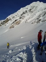
| Can't wait! | First a long traverse to get to a nice bowl with less wind affected snow. Bamboo sticks mark the roads for the cats |
 |
 |
") |
||
| Loading the cat | Loading the cat | Searching for more fresh tracks :) |
 |
 |
") |
||
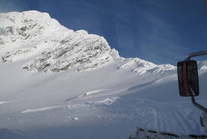
| We drove to the top of the ridge | Now we are pretty high up. GPS showed 2,800 meters or so (lodge was ~1700m) |
 |
 |
 |
||
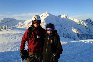
| We are high and it's beautiful. The snow is very wind hammered on top, but better once you drop in | Quick, load on the cat so we can do another run!!! | Bluebird day in a beautiful place! |
 |
 |
 |
||
| One of the very few photos I took | Last run of the day. |
 |
") |
 |
||
| One of the two cats: Carlos | Carlos and Harold, buddies :) | Revelstoke |
 |
 |
||
| View from the top of the ridge before our last run for the day | Revelstoke ski resort |